
group-telegram.com/esrirus/1137
Last Update:
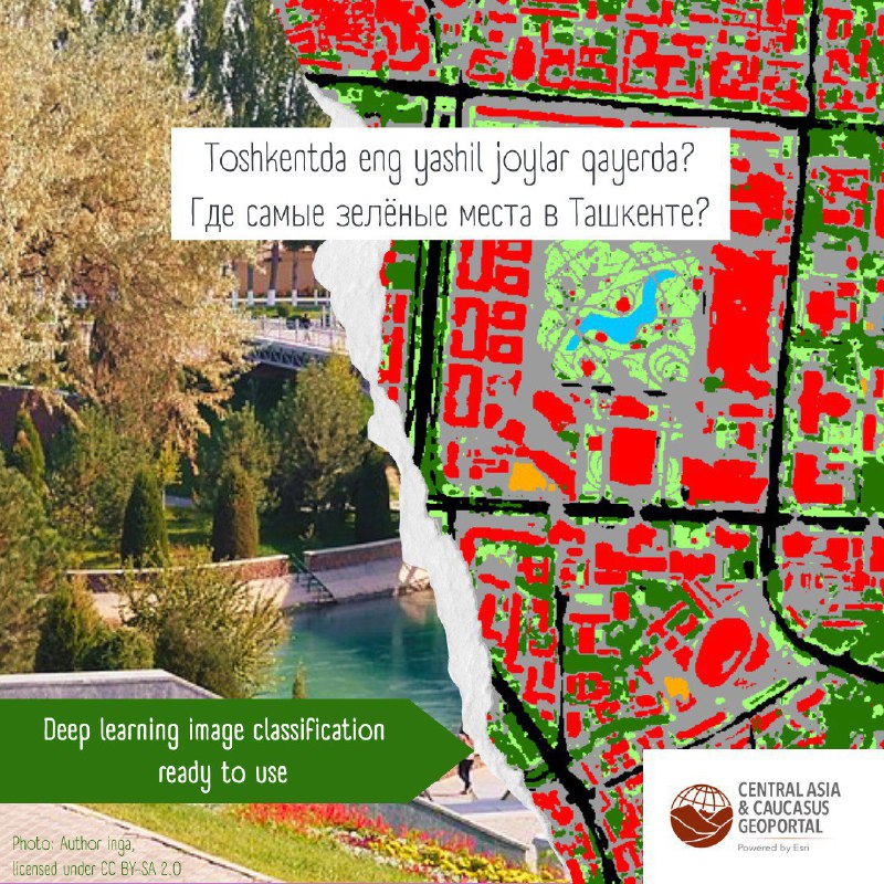
Классификация ландшафтов Ташкента с помощью GeoAI
Специалисты компании Data+ International использовали технологии GeoAI для создания обученной модели классификации городских ландшафтов. Эта модель была применена к спутниковым данным высокого разрешения по городу Ташкент.
Ознакомиться с результатами классификации можно Геопортале по ссылке.
Подробное описание методики и модели опубликовано в статье блога.
Land Cover Classification of Tashkent Using GeoAI
Specialists from Data+ International utilized GeoAI technologies to develop a trained model for urban land cover classification. This model was applied to high-resolution satellite imagery of the city of Tashkent.
You can explore the classification results on the Geoportal via the following link.
A detailed description of the methodology and the model is available in the blog post.
BY ГИС | Esri | Data+ | ArcGIS
Share with your friend now:
group-telegram.com/esrirus/1137